
Map my photos on a world map, automatically, from the GPS location stored in each picture.
MapMyShots is a simple Windows 10/11 app that creates a world map from your photo library and shows how many and which photos were taken in each place.
Free for Windows 10 and Windows 11
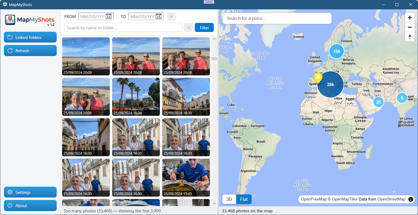
Choose a folder and let the app build a photo map from your GPS locations automatically.
Your database stays local on your PC. No cloud upload. Privacy assured.
Use MapMyShots for free with your own photo collection.
Download MapMyShots for Windows and point it to the folders that contain your pictures. The app reads the GPS data already stored in each photo and places it on a world map automatically. There is nothing to configure.
Yes. MapMyShots scans your photos and stores everything in a local database on your computer, with no account and no cloud upload. An internet connection is only used to load the map background.
Yes, MapMyShots is completely free for Windows 10 and Windows 11. There is no account, no subscription and no premium upsell.
No. Your photos never leave your computer. MapMyShots only reads the GPS and EXIF metadata locally; the photos stay in their original folders and nothing is sent to any server.